Fall storms dominate the weather in 2019
Published 6:20 am Wednesday, January 15, 2020

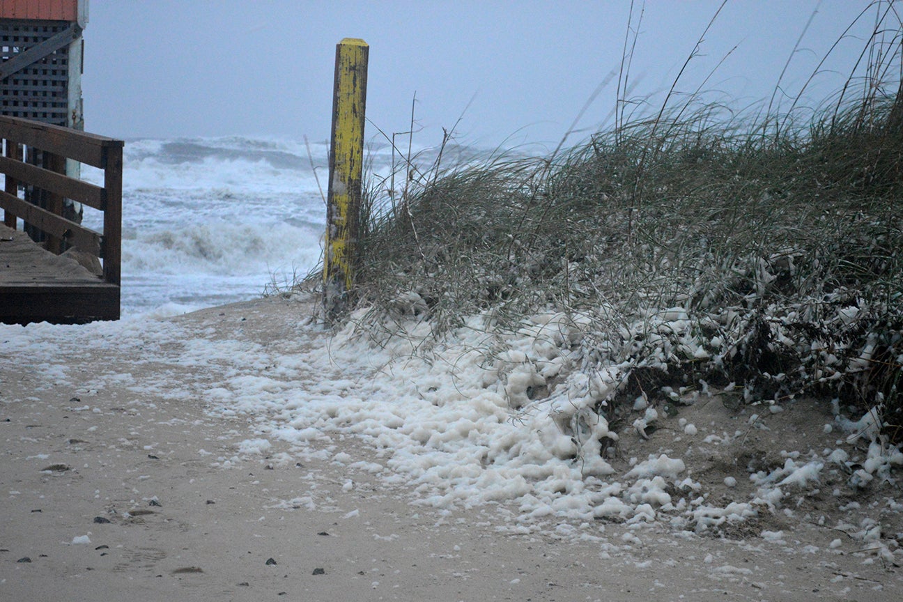
- On Nov. 17, an angry Atlantic Ocean generated sea foam that looked like snow from a distance. The coastal storm closed NC 12. Mary Helen Goodloe-Murphy
Dominating the Outer Banks were 2019 fall storms.
At 8:45 a.m. on Sept. 6, Hurricane Dorian made landfall on Hatteras Island. The storm devastated Ocracoke Island and flooded Hatteras, Frisco, Buxton and Avon.
All of Hatteras Island was without power. A curfew was placed on the island.
By the evening of Sept. 7, permanent residents and critical employees were allowed back on the Hatteras Island, carefully traveling NC 12.
In the storm’s aftermath, an extensive period of recovery started. That recovery continues to this day on Hatteras and Ocracoke islands.
For example, FEMA grant funds for home elevation are now available for Hurricane Dorian. Community meetings are scheduled for Tuesday, Jan. 7 from 5 to 6 p.m. at the Fessenden Center in Buxton and on Wednesday, Jan. 8 from 5 to 6 p.m. in Room 168 of the Dare County Administration Building in Manteo.
“The program provides 100% funding to reduce or eliminate the risk of flood damage to buildings and structures,” states a notice from Dare County.
In October, tropical storm Melissa came to visit starting Oct. 10 and going through Oct. 13. The ocean’s waves were relentless, gobbling up sand and streaming across NC 12 in Pea Island National Wildlife Refuge, in Avon and in Buxton on Hatteras Island.
NC 12 was initially closed from the Oregon Inlet bridge to Rodanthe on the evening of Oct. 10, reopened and reclosed as high tides dumped more sand on the road in the refuge. Vehicles going around barricades got stuck. Dunes were repeatedly washed out flooding NC 12 in the Pea Island Refuge and Avon. NC 12 reopened Monday, Oct. 14.
In late October, the remnants of tropical storm Nestor quickly passed over the coast. The fast-moving low pressure system moved up from the Gulf Coast with impacts on the Oct. 19-20 weekend. The National Weather Service in Newport reported “local impacts are not dependent on tropical characteristics after landfall.”
In mid-November, another coastal storm hit. On Nov. 16, NC 12 was closed between Rodanthe and the Oregon Inlet bridge. The storm dumped a massive amount of sand on NC 12 pavement. Again, oceanside flooding hit Rodanthe, Avon and Buxton. Soundside flooding came to Hatteras and Frisco. The road reopened Nov. 20.
Some briefs about the 2019 from the National Weather Service’s monthly climate review:
January: Above normal temperatures in the first half. Highest temp was 68 degrees in Frisco. February: Abnormally mild temperatures, the same as a year earlier. High temperature was 73 degrees at Frisco airport. Rainfall at Cape Hatteras was 6.67 inches, 2.65 inches above normal.
March: Again, abnormally mild temperatures and drier than average. The highest temperature was 74 on the Ides of March. The lowest was 27 degrees on March 7. Only 2.15 inches of rain was measured at the Frisco airport. That was 2.62 inches below normal. A weak low moved off the coast on March 3 and 4. The same weather pattern happened on the same days in February.
April: At the start, a rapidly deepening offshore low brought heavy rain and windy conditions. This event, along with another round of strong thunderstorms and heavy rain, made April wetter than average. At Cape Hatteras, 8.61 of rain fell. That was 5 inches above normal. Hatteras Island was soggy. On three days, the temperature reached 79 degrees. On April Fool’s Day, the temp was 42.
May. Frisco airport saw its warmest May since 1957. On May 29, the month’s high temperature was reached at 90 degrees. The lowest was 55 degrees on May 7. The average temperature was 7 degrees higher. The average low temperature was 6.5 degrees higher. More rain came. Frisco airport registered 6 inches of rain, 2.47 inches above normal.
June. By month’s end, only 2.49 inches of rain had fallen, 1.54 inches below the normal. On June 27, the temperature hit 94 degrees. It was cooler on the June 15 when the temp was 57 degrees.
July: Drier than normal for Hatteras Island. Only 2.4 inches of rain fell at the Frisco airport. That’s 2.57 inches lower than normal. The temperature hit 92 degrees twice and registered 63 degrees once. The average temperature was 3 degrees higher. The low temperature was two degrees higher.
August: Severe weather started. On Aug. 5, waterspouts were observed along the northern Outer Banks. A tropical outlook was published Aug. 23. Rain was measured at 7 inches, about normal for the month. The hottest day was Aug. 13 at 92 degrees and the last two days of the month recorded the low at 65 degrees. Both the high and low temperatures were three degrees above the average.
September: Due to excessive outages at the weather station in the Frisco airport, no temperatures and rainfall totals were reported. The storms came.
READ ABOUT MORE NEWS AND EVENTS HERE.
RECENT HEADLINES:
Kill Devil Hills approves changes to soil erosion/sedimentation control amendment
Kitty Hawk agrees to proposal for post-Dorian beach survey and analysis


