Isaias brings increased risk for rip currents now through early next week
Published 7:59 am Saturday, August 1, 2020

- NOAA image
|
Getting your Trinity Audio player ready...
|
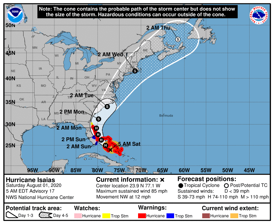
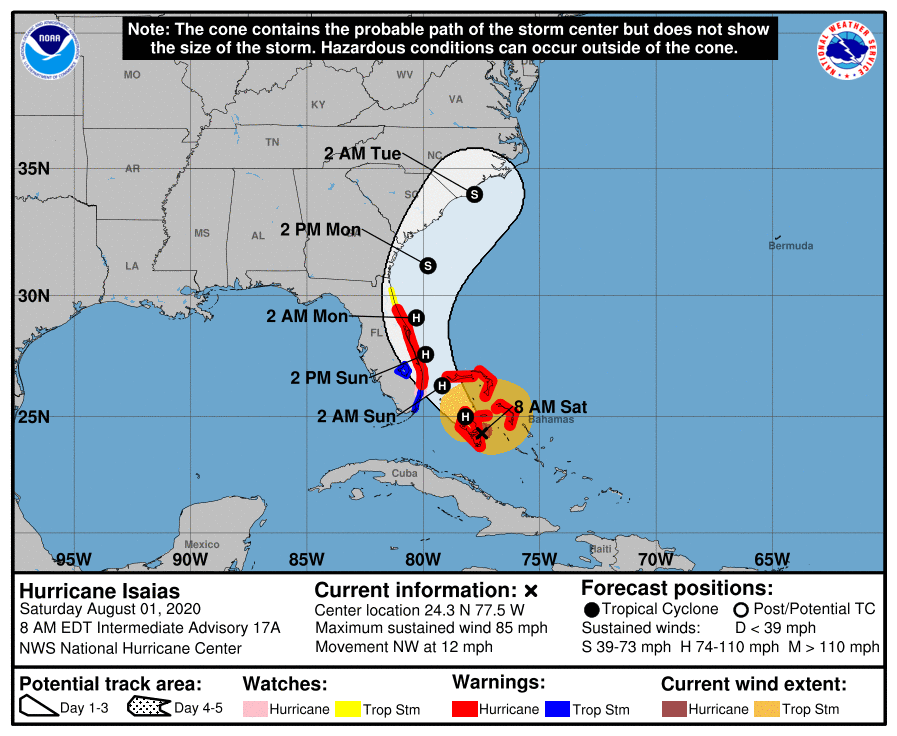
The National Weather Service Newport/Morehead City’s Hurricane Isaias briefing for 6 a.m. Saturday, August 1 states confidence in the track forecast is high at this time, however confidence is rated as medium for timing and intensity of the storm. “Small changes in track can result in big changes in expected impacts,” states the overview.
Hurricane Isaias has a current intensity of 85 mph. First impacts from the system are increased swell and rip current risk arriving now – early Saturday morning – through early next week.
For Saturday, the NWS beach forecast calls for moderate rip current risk in the northern Outer Banks area beaches with surf height at 2 to 3 feet and high potential for thunderstorms. The UV index is listed as very high. West winds are around 5 mph, becoming southeast in the afternoon.
Along southern Outer Banks beaches on Saturday, the NWS beach forecast rates the rip current risk as high, meaning surf is dangerous for swimmers of all levels of expertise. Surf height is 3 to 5 feet with moderate thunderstorm potential, southwest winds around 15 mph and a very high UV index.
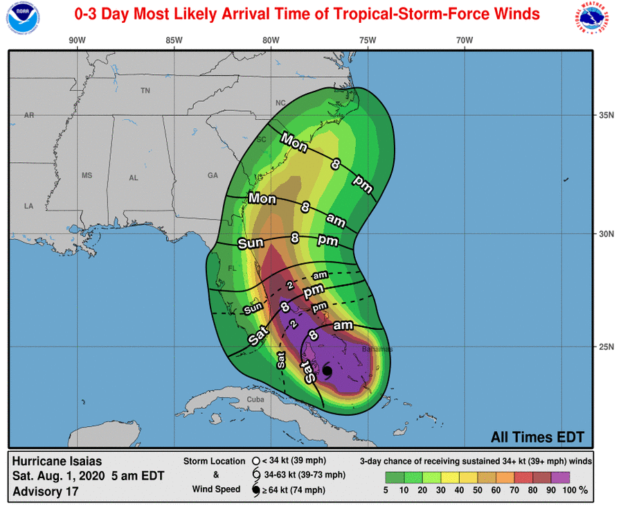
The briefing states tropical storm conditions could begin as early as Monday evening in eastern North Carolina, however the most likely time the area could see tropical storm force winds will be late Monday night or early Tuesday morning. There is potential for hurricane force winds, power outages and downed trees.
Storm surge inundation is possible along the coast and local sounds and rivers. There is an increasing threat for tornadoes. Localized heavy rain is possible, but the storm’s motion may limit the overall threat, according to the briefing.
“Now is the time to check your hurricane plan and supplies,” advises the briefing. “We are entering the most active portion of hurricane season. More info found at weather.gov/mhx/hurricaneprep.”
READ ABOUT MORE NEWS AND EVENTS HERE.
RECENT HEADLINES:


