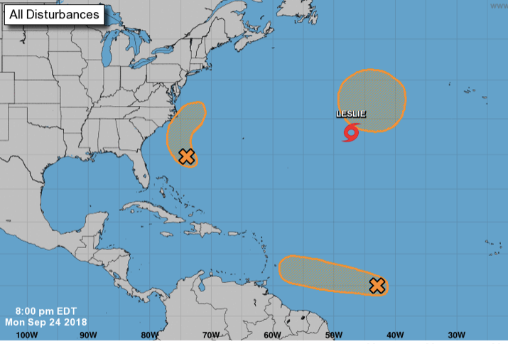
Tropical disturbance swirls off Cape Hatteras
Published 10:59 pm Monday, September 24, 2018

- National Hurricane Center
Conditions are conducive for a broad area of low pressure about 400 miles south-southeast of Cape Hatteras to become a tropical depression tonight or Tuesday.
The system is expected to move west-northwestward to northwestward, with upper level winds increasing, limiting chances for the tropical wave to development into a more organized storm, according to National Hurricane Center.
Regardless, the system will mean some rainfall for northeastern and easter North Carolina Tuesday and Tuesday night, the center said.
The system is also whipping up dangerous surf and rip currents along portions of the North Carolina coast.
Stay with thecoastlandtimes.com for updates.


