Hurricane Florence to bring swells, dangerous surf
Published 3:00 pm Thursday, September 6, 2018

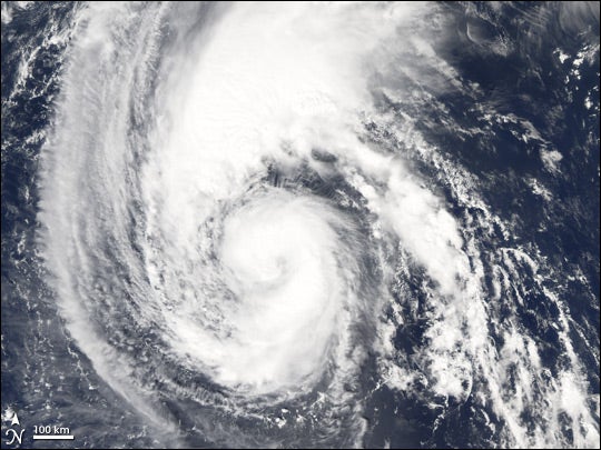
- Hurricane Florence, NOAA satellite image
Forecasters say it’s too soon to tell where Hurricane Florence may go into next week, but storm swell will begin to impact our beaches starting this weekend.
The National Weather Service Morehead City office says the storm will mean an increased risk for rip currents, dangerous surf, and potentially coastal wave run-up and beach erosion.
Hurricane Florence weakened to a Category 2 hurricane on Thursday, with maximum sustained winds of 105 mph.
“Additional weakening during the next day or two is forecast,” the National Hurricane Center said in a Thursday alert. “However, Florence is expected to remain a hurricane and likely re-intensify over the weekend.”
The cyclone is expected to take a turn toward the west-northwest and west with a decrease in forward speed through Saturday.
“Then, Florence may begin to move faster toward the west-northwest over the western Atlantic early next week,” the hurricane center said. “There is still considerable model ensemble spread for Florence’s track … Given the large uncertainty at these time ranges, it is far too soon to speculate what, if any, impacts Florence may have on the U.S. East Coast next week.”
Dare County Emergency Management is urging residents and visitors to sign up for emergency alerts ahead of any potential impact to stay current with local information. Sign up for free athttp://darenc.com/emergencyalerts .


